Datei:Atlantic Ocean laea location map.svg

Größe der PNG-Vorschau dieser SVG-Datei: 491 × 599 Pixel. Weitere Auflésungan: 197 × 240 Pixel | 393 × 480 Pixel | 629 × 768 Pixel | 839 × 1.024 Pixel | 1.679 × 2.048 Pixel | 709 × 865 Pixel.
Version in hechara Auflesung (SVG-Datei, Basisgress: 709 × 865 Pixl, Dateigress: 274 KB)
Bschreiwung
| Bschreiwung |
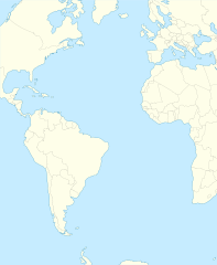
English: Relief location map of Atlantic_Ocean.
|
| Daatum | |
| Quejn | Eigenes Werk |
| Urhéwer | Tentotwo |
Shell script for generating the map using GMT Archivkopie in der Wayback Machine
#!/bin/sh

# Set common options
PROJECTION=A-35.0/0.0/180/19.998266666666666c
REGION=-147.58842045747764/-48.58942183011819/77.58842045747762/48.589421830118205r
FILENAME=Atlantic_Ocean_laea_location_map.ps

# Get Natural Earth datafiles
echo "Downloading datafiles from naturalearthdata.com"
wget -nv -nc \
 http://www.naturalearthdata.com/http//www.naturalearthdata.com/download/110m/physical/110m-coastline.zip\
 http://www.naturalearthdata.com/http//www.naturalearthdata.com/download/110m/physical/110m-land.zip\
 http://www.naturalearthdata.com/http//www.naturalearthdata.com/download/110m/cultural/110m-admin-0-boundary-lines.zip
echo "...done\n"

echo "Inflating archives"
unzip 110m\*.zip
echo "...done\n"

echo "Converting shapefiles to GMT"
ogr2ogr -F GMT 110m_land.gmt 110m_land.shp
ogr2ogr -F GMT 110m_coastline.gmt 110m_coastline.shp
ogr2ogr -F GMT 110m_borders.gmt ne_110m_admin_0_boundary_lines_land.shp
echo "...done\n"

echo "Creating maps"
GMT psxy -m -J$PROJECTION -R$REGION -Bg15 -P --PAGE_COLOR=198/236/255  --POLAR_CAP=none --BASEMAP_TYPE=plain --BASEMAP_AXES=NESW --FRAME_PEN=0.15p,black 110m_land.gmt -K -G254/254/233 > $FILENAME
GMT psxy -m -J$PROJECTION -R$REGION 110m_coastline.gmt -O -K -W0.535p,9/120/171  >> $FILENAME
GMT psxy -m -J$PROJECTION -R$REGION 110m_borders.gmt -O -W100/100/100  >> $FILENAME
echo "...done\n"

echo "You can now open $FILENAME in Inkscape to clean up the file and save it as SVG. You should add an ocean coloured background and simplify the graticules using CTRL+L."

gv $FILENAME
Lizenz
Diese Datei ist unter der Creative-Commons-Lizenz „Namensnennung – Weitergabe unter gleichen Bedingungen 3.0 nicht portiert“ lizenziert.
- Dieses Werk darf von dir
- vabroatt wern – vafüfötigt, vabroatt und éffantlich zuegénglich gmocht wern.
- neu zusammengestellt werden – abgewandelt und bearbeitet werden
- Zu den folgenden Bedingungen:
- Nåmansnénnung – Du musst angemessene Urheber- und Rechteangaben machen, einen Link zur Lizenz beifügen und angeben, ob Änderungen vorgenommen wurden. Diese Angaben dürfen in jeder angemessenen Art und Weise gemacht werden, allerdings nicht so, dass der Eindruck entsteht, der Lizenzgeber unterstütze gerade dich oder deine Nutzung besonders.
- Weidergob unter gleiche Bedingungan – Wenn du das Material wiedermischst, transformierst oder darauf aufbaust, musst du deine Beiträge unter der gleichen oder einer kompatiblen Lizenz wie das Original verbreiten.
Dateiversiona
Wensd auf an Zeitpunkt klickst, nacha konst a friaane Version lodn.
| Version vom | Vorschaubuidl | Dimensióna | Nutzer | Kommentar | |
|---|---|---|---|---|---|
| aktuell | 23:19, 31. Jén. 2012 | | 709 × 865 (274 KB) | Tentotwo | Corrected colour of black sea |
| 23:17, 31. Jén. 2012 |  | 709 × 865 (298 KB) | Tentotwo | Included border of South Sudan | |
| 15:38, 31. Jén. 2012 |  | 709 × 865 (248 KB) | Tentotwo | Removed grid line | |
| 15:36, 31. Jén. 2012 |  | 709 × 865 (239 KB) | Tentotwo |
Dateivawendung
Seitn wo de Datei nutzn:
Globale Dateinutzung
D'noochéfóiganden åndern Wikis vawénden dé Datei:
- Vawendung af af.wikipedia.org
- Vawendung af als.wikipedia.org
- Vawendung af ar.wikipedia.org
- Vawendung af ast.wikipedia.org
- Vawendung af azb.wikipedia.org
- Vawendung af be-tarask.wikipedia.org
- Vawendung af be.wikipedia.org
- Vawendung af ceb.wikipedia.org
- Plantilya:Location map Atlantic Ocean
- South Point
- Scotts Hill
- Saddle Hill
- The Ridge
- Pillar Rock
- James Bay
- Castle Hill
- Bird Island
- North Point
- West Point
- Sandy Point
- Black Point
- Powell Point
- Black Rock
- Egg Island
- East Point
- White Rock
- White Point
- Whale Point
- Long Point
- The Bluff
- Middle Point
- Crown Point
- Channel Rock
- Cave Point
- Blue Hill
- South West Point
- White Bluff
- Sandy Bay
- George Island
- South West Bay
Weitere globale Verwendungen dieser Datei anschauen.