Datei:C81195s1 Ant.Map Mount Nares.jpg

Gress dea Voaschau: 711 × 600 Pixel Weitere Auflésungan: 285 × 240 Pixel | 569 × 480 Pixel | 910 × 768 Pixel | 1.214 × 1.024 Pixel | 2.428 × 2.048 Pixel | 3.845 × 3.244 Pixel.
Version in hechara Auflesung (3.845 × 3.244 Pixel, Dateigress: 1,69 MB, MIME-Typ: image/jpeg)
| Bschreiwung |
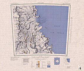
English: Map of Antarctica by the United States Antarctic Resource Center of the US Geological Survey. |
| Daatum | |
| Quejn | USGS |
| Urhéwer | United States Geological Survey |
Dieses Bild ist gemeinfrei (public domain), weil es Materialien beeinhaltet, die ursprünglich vom United States Geological Survey, einer Behörde des Innenministeriums der Vereinigten Staaten, stammen. Weitere Informationen finden Sie in den Urheberrechtsbestimmungen des USGS
|
Dateiversiona
Wensd auf an Zeitpunkt klickst, nacha konst a friaane Version lodn.
| Version vom | Vorschaubuidl | Dimensióna | Nutzer | Kommentar | |
|---|---|---|---|---|---|
| aktuell | 14:03, 4. Apr. 2005 | | 3.845 × 3.244 (1,69 MB) | Achim Raschka | Map of Antarctica by the United States Antarctic Ressource Center of the US Geological Society. {{PD-US}} Copyrights and Trademarks USGS-authored or produced data and information are in the public domain. While the content of most USGS web pages is in th |
Dateivawendung
Seitn wo de Datei nutzn:
Globale Dateinutzung
D'noochéfóiganden åndern Wikis vawénden dé Datei:
- Vawendung af ar.wikipedia.org
- Vawendung af ceb.wikipedia.org
- Vawendung af de.wikipedia.org
- Churchill Mountains
- Nash Range
- Flynn-Gletscher
- Dickey-Gletscher
- Starshot-Gletscher
- Kelly-Plateau
- Surveyors Range
- Beaumont Bay
- Silk-Gletscher
- Jorda-Gletscher
- Kap Parr
- Young Head
- Harris Point
- Nursery-Gletscher
- Darley Hills
- Shackleton-Küste
- Boyer Bluff
- Bridge-Pass
- Brown Buttress
- Deverall Island
- Donnally-Gletscher
- Swithinbank Range
- Kap Laird
- Vawendung af en.wikipedia.org
- Vawendung af es.wikipedia.org
- Vawendung af ga.wikipedia.org
- Vawendung af he.wikipedia.org
- Vawendung af hu.wikipedia.org
- Vawendung af it.wikipedia.org
Weitere globale Verwendungen dieser Datei anschauen.