Datei:EnglandCumbria.svg

Größe der PNG-Vorschau dieser SVG-Datei: 200 × 247 Pixel. Weitere Auflésungan: 194 × 240 Pixel | 389 × 480 Pixel | 622 × 768 Pixel | 829 × 1.024 Pixel | 1.658 × 2.048 Pixel.
Version in hechara Auflesung (SVG-Datei, Basisgress: 200 × 247 Pixl, Dateigress: 231 KB)
Bschreiwung
| Bschreiwung |
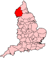
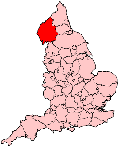
English: Map of the administrative county of Cumbria. |
| Quejn | Eigenes Werk |
| Urhéwer | Wereon |
Lizenz
| Ich, der Urheberrechtsinhaber dieses Werkes, veröffentliche es als gemeinfrei. Dies gilt weltweit. In manchen Staaten könnte dies rechtlich nicht möglich sein. Sofern dies der Fall ist: Ich gewähre jedem das bedingungslose Recht, dieses Werk für jedweden Zweck zu nutzen, es sei denn, Bedingungen sind gesetzlich erforderlich. |
Dateiversiona
Wensd auf an Zeitpunkt klickst, nacha konst a friaane Version lodn.
| Version vom | Vorschaubuidl | Dimensióna | Nutzer | Kommentar | |
|---|---|---|---|---|---|
| aktuell | 22:15, 22. Apr. 2007 | | 200 × 247 (231 KB) | Wereon | Map of the administrative county of Cumbria. Category:Maps of counties of England |
Dateivawendung
Seitn wo de Datei nutzn:
Globale Dateinutzung
D'noochéfóiganden åndern Wikis vawénden dé Datei:
- Vawendung af cy.wikipedia.org
- Vawendung af en.wikipedia.org
- Workington (UK Parliament constituency)
- Carlisle (UK Parliament constituency)
- Copeland (UK Parliament constituency)
- Penrith and The Border (UK Parliament constituency)
- Westmorland and Lonsdale (UK Parliament constituency)
- Barrow and Furness (UK Parliament constituency)
- Portal:Cheshire
- Portal:Cheshire/Related portals
- Parliamentary constituencies in North West England
- Vawendung af pl.wikipedia.org
- Vawendung af ru.wikipedia.org
- Vawendung af uk.wikipedia.org