Datei:Map of Montana highlighting Missoula County.svg

Größe der PNG-Vorschau dieser SVG-Datei: 800 × 461 Pixel. Weitere Auflésungan: 320 × 185 Pixel | 640 × 369 Pixel | 1.024 × 591 Pixel | 1.280 × 738 Pixel | 2.560 × 1.477 Pixel | 9.194 × 5.303 Pixel.
Version in hechara Auflesung (SVG-Datei, Basisgress: 9.194 × 5.303 Pixl, Dateigress: 122 KB)
Bschreiwung
| Bschreiwung |
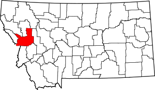
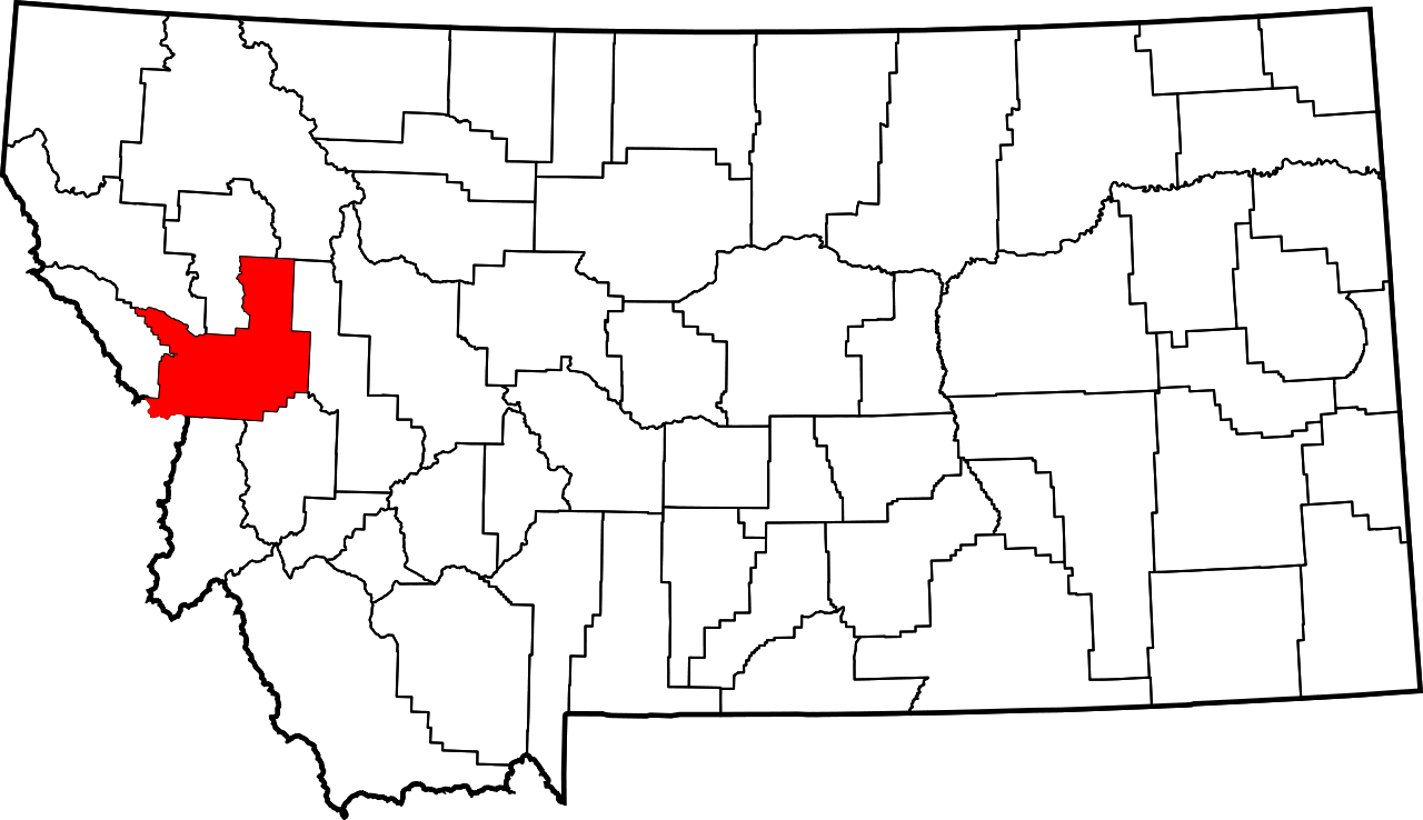
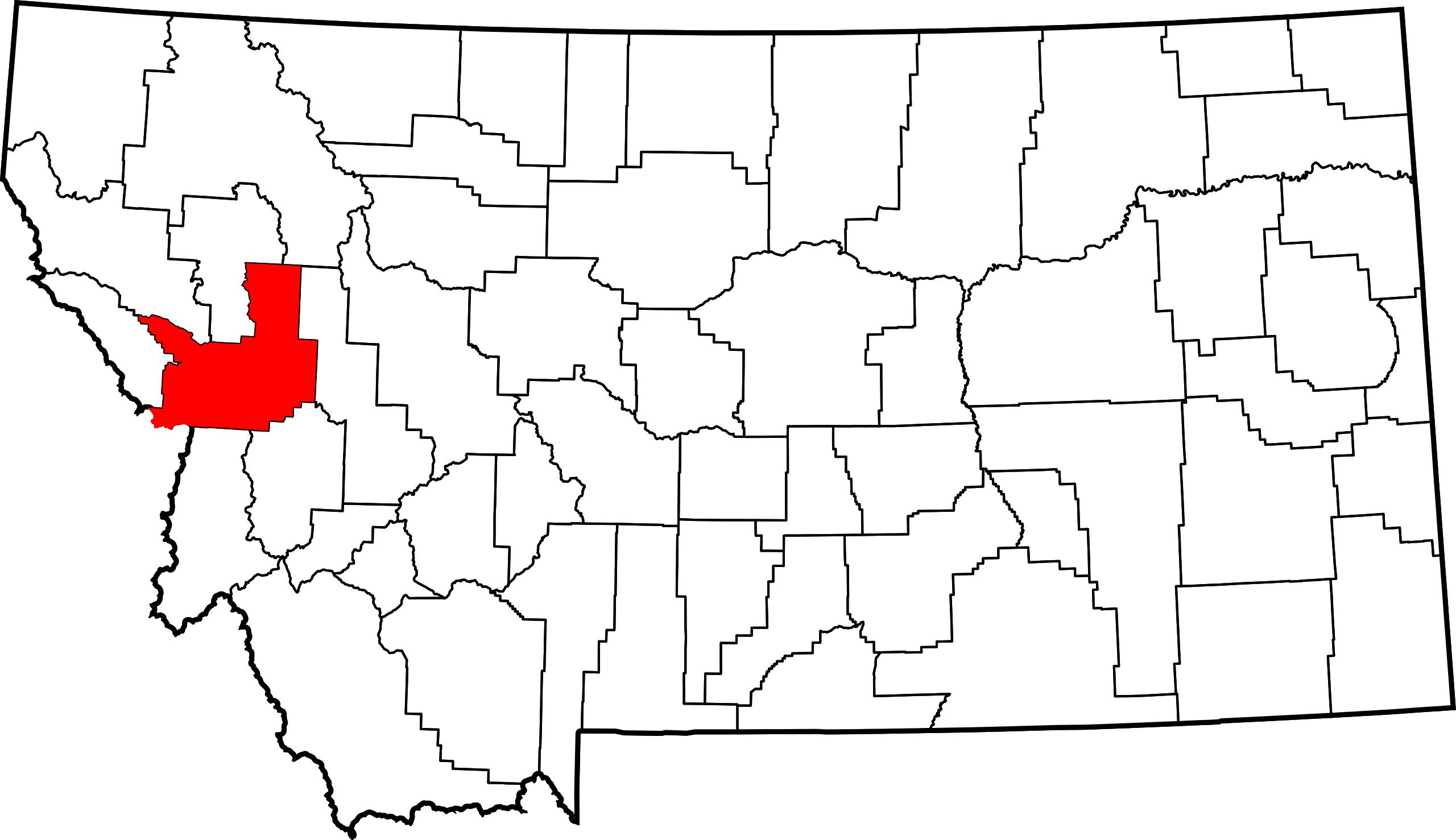
English: This is a locator map showing Missoula County in Montana. For more information, see Commons:United States county locator maps. |
| Daatum | |
| Quejn |
Eigenes Werk: English: The maps use data from nationalatlas.gov, specifically countyp020.tar.gz on the Raw Data Download page. The maps also use state outline data from statesp020.tar.gz. The Florida maps use hydrogm020.tar.gz to display Lake Okeechobee. |
| Urhéwer | David Benbennick |
Lizenz
| Ich, der Urheberrechtsinhaber dieses Werkes, veröffentliche es als gemeinfrei. Dies gilt weltweit. In manchen Staaten könnte dies rechtlich nicht möglich sein. Sofern dies der Fall ist: Ich gewähre jedem das bedingungslose Recht, dieses Werk für jedweden Zweck zu nutzen, es sei denn, Bedingungen sind gesetzlich erforderlich. |
Dateiversiona
Wensd auf an Zeitpunkt klickst, nacha konst a friaane Version lodn.
| Version vom | Vorschaubuidl | Dimensióna | Nutzer | Kommentar | |
|---|---|---|---|---|---|
| aktuell | 15:30, 12. Few. 2006 | | 9.194 × 5.303 (122 KB) | David Benbennick | {{subst:User:Dbenbenn/clm|county=Missoula County|state=Montana|type=county}} |
Dateivawendung
Seitn wo de Datei nutzn:
Globale Dateinutzung
D'noochéfóiganden åndern Wikis vawénden dé Datei:
- Vawendung af ar.wikipedia.org
- Vawendung af bg.wikipedia.org
- Vawendung af bpy.wikipedia.org
- Vawendung af ca.wikipedia.org
- Vawendung af cdo.wikipedia.org
- Vawendung af ceb.wikipedia.org
- Vawendung af cy.wikipedia.org
- Vawendung af de.wikipedia.org
- Vawendung af en.wikipedia.org
- List of counties in Montana
- Missoula County, Montana
- Bonner-West Riverside, Montana
- Clinton, Montana
- East Missoula, Montana
- Evaro, Montana
- Frenchtown, Montana
- Lolo, Montana
- Missoula, Montana
- Orchard Homes, Montana
- Seeley Lake, Montana
- Wye, Montana
- Flathead Indian Reservation
- Lolo Hot Springs, Montana
- User:Nyttend/County templates/MT
- Template:Missoula County, Montana
- Condon, Montana
Weitere globale Verwendungen dieser Datei anschauen.