Datei:Map of Oregon highlighting Curry County.svg

Größe der PNG-Vorschau dieser SVG-Datei: 800 × 596 Pixel. Weitere Auflésungan: 320 × 239 Pixel | 640 × 477 Pixel | 1.024 × 764 Pixel | 1.280 × 954 Pixel | 2.560 × 1.909 Pixel | 6.451 × 4.810 Pixel.
Version in hechara Auflesung (SVG-Datei, Basisgress: 6.451 × 4.810 Pixl, Dateigress: 136 KB)
Bschreiwung
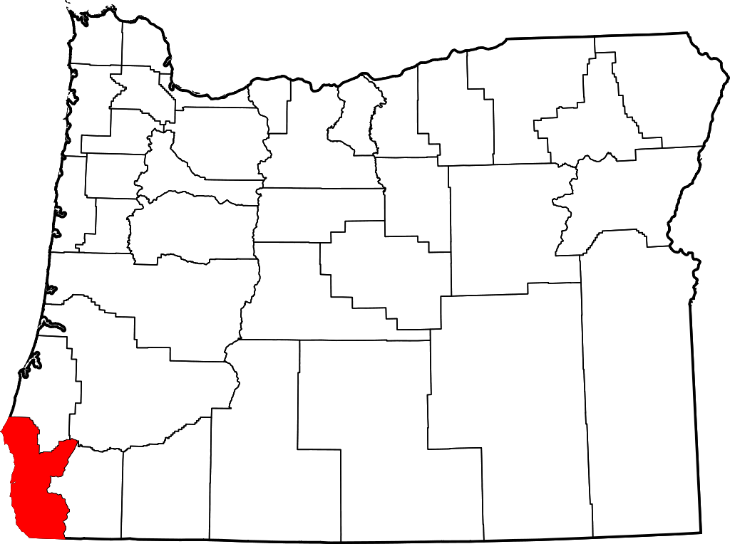
- Locator map of Curry County in southwestern Oregon.
David Benbennick made this map. For more information, see Commons:United States county locator maps.
| Ich, der Urheberrechtsinhaber dieses Werkes, veröffentliche es als gemeinfrei. Dies gilt weltweit. In manchen Staaten könnte dies rechtlich nicht möglich sein. Sofern dies der Fall ist: Ich gewähre jedem das bedingungslose Recht, dieses Werk für jedweden Zweck zu nutzen, es sei denn, Bedingungen sind gesetzlich erforderlich. |
Dateiversiona
Wensd auf an Zeitpunkt klickst, nacha konst a friaane Version lodn.
| Version vom | Vorschaubuidl | Dimensióna | Nutzer | Kommentar | |
|---|---|---|---|---|---|
| aktuell | 18:16, 12. Few. 2006 | | 6.451 × 4.810 (136 KB) | David Benbennick | {{subst:User:Dbenbenn/clm|county=Curry County|state=Oregon|type=county}} |
Dateivawendung
Seitn wo de Datei nutzn:
Globale Dateinutzung
D'noochéfóiganden åndern Wikis vawénden dé Datei:
- Vawendung af ar.wikipedia.org
- Vawendung af bg.wikipedia.org
- Vawendung af bpy.wikipedia.org
- Vawendung af ca.wikipedia.org
- Vawendung af cdo.wikipedia.org
- Vawendung af ceb.wikipedia.org
- Vawendung af ce.wikipedia.org
- Vawendung af cy.wikipedia.org
- Vawendung af de.wikipedia.org
- Vawendung af en.wikipedia.org
- List of counties in Oregon
- Curry County, Oregon
- Brookings, Oregon
- Gold Beach, Oregon
- Harbor, Oregon
- Port Orford, Oregon
- Confederated Tribes of Coos, Lower Umpqua and Siuslaw Indians
- Langlois, Oregon
- Agness, Oregon
- Carpenterville, Oregon
- Pistol River, Oregon
- Sixes, Oregon
- Wedderburn, Oregon
- Template:Curry County, Oregon
- Nesika Beach, Oregon
- User:Nyttend/County templates/OR
- Ophir, Oregon
- National Register of Historic Places listings in Curry County, Oregon
- User:Lhammer610/Sandbox
- Ophir Beach
- Barley Beach
- Illahe, Oregon
- Marial, Oregon
- Denmark, Oregon
- Category:Populated places in Curry County, Oregon
- Bagnell Ferry, Oregon
- Plum Trees, Oregon
- Hunter Creek, Oregon
- Frankport, Oregon
- User:AridCeption/sandbox
Weitere globale Verwendungen dieser Datei anschauen.