Datei:Map of Wyoming highlighting Platte County.svg

Größe der PNG-Vorschau dieser SVG-Datei: 783 × 599 Pixel. Weitere Auflésungan: 314 × 240 Pixel | 627 × 480 Pixel | 1.003 × 768 Pixel | 1.280 × 980 Pixel | 2.560 × 1.960 Pixel | 5.883 × 4.504 Pixel.
Version in hechara Auflesung (SVG-Datei, Basisgress: 5.883 × 4.504 Pixl, Dateigress: 26 KB)
Bschreiwung
| Bschreiwung |
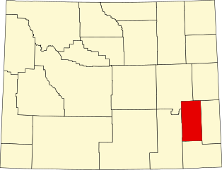
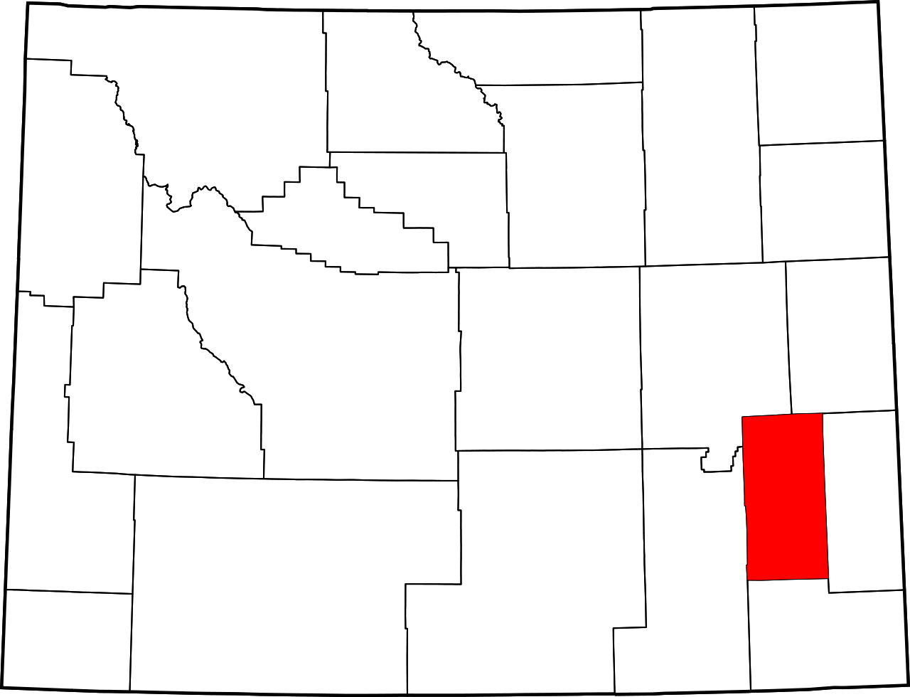
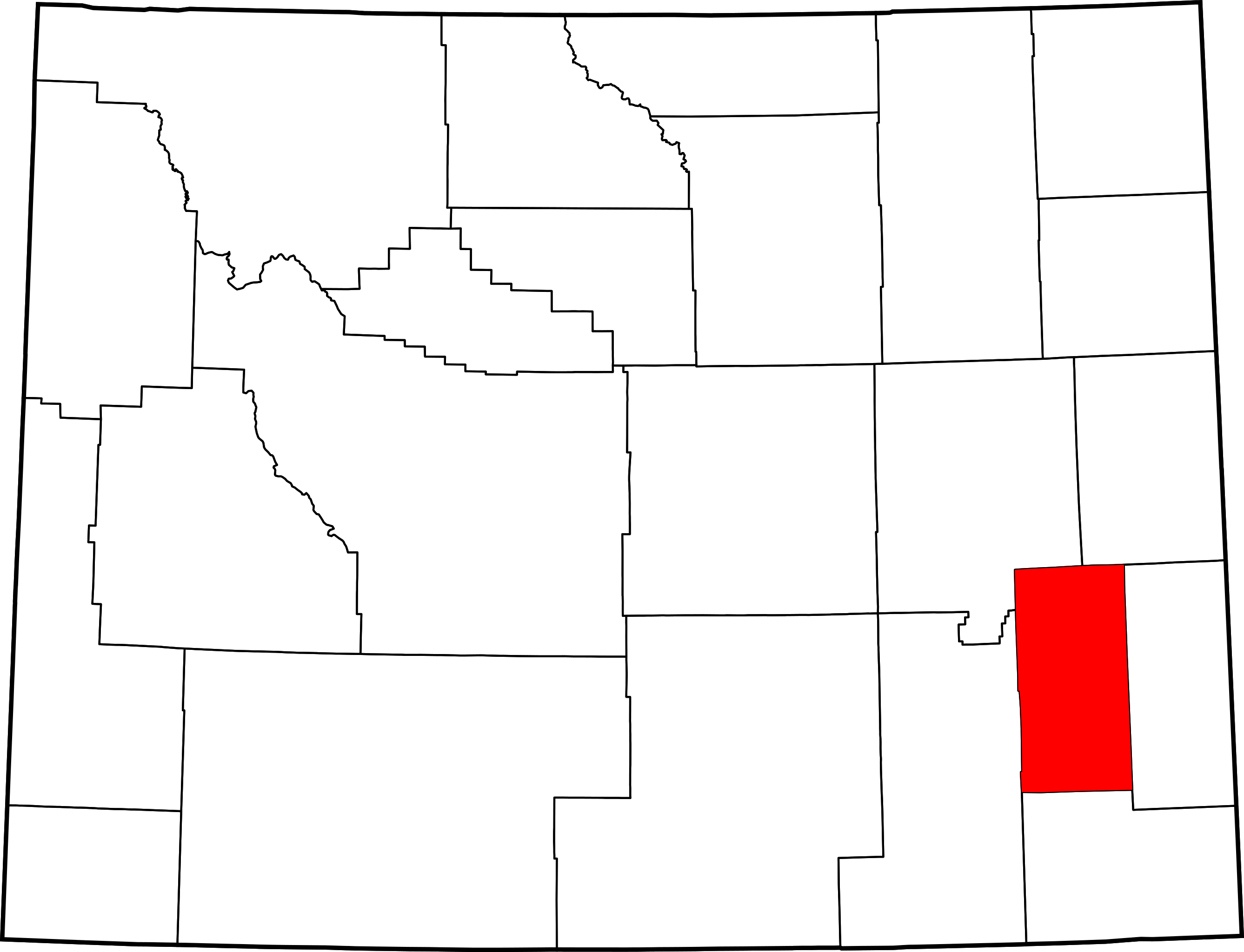
English: This is a locator map showing Platte County in Wyoming. For more information, see Commons:United States county locator maps. |
| Daatum | |
| Quejn |
Eigenes Werk: English: The maps use data from nationalatlas.gov, specifically countyp020.tar.gz on the Raw Data Download page. The maps also use state outline data from statesp020.tar.gz. The Florida maps use hydrogm020.tar.gz to display Lake Okeechobee. |
| Urhéwer | David Benbennick |
Lizenz
| Ich, der Urheberrechtsinhaber dieses Werkes, veröffentliche es als gemeinfrei. Dies gilt weltweit. In manchen Staaten könnte dies rechtlich nicht möglich sein. Sofern dies der Fall ist: Ich gewähre jedem das bedingungslose Recht, dieses Werk für jedweden Zweck zu nutzen, es sei denn, Bedingungen sind gesetzlich erforderlich. |
Dateiversiona
Wensd auf an Zeitpunkt klickst, nacha konst a friaane Version lodn.
| Version vom | Vorschaubuidl | Dimensióna | Nutzer | Kommentar | |
|---|---|---|---|---|---|
| aktuell | 20:25, 12. Few. 2006 | | 5.883 × 4.504 (26 KB) | David Benbennick | {{subst:User:Dbenbenn/clm|county=Platte County|state=Wyoming|type=county}} |
Dateivawendung
Seitn wo de Datei nutzn:
Globale Dateinutzung
D'noochéfóiganden åndern Wikis vawénden dé Datei:
- Vawendung af ar.wikipedia.org
- Vawendung af bg.wikipedia.org
- Vawendung af bpy.wikipedia.org
- Vawendung af ca.wikipedia.org
- Vawendung af cdo.wikipedia.org
- Vawendung af ceb.wikipedia.org
- Vawendung af ce.wikipedia.org
- Vawendung af cy.wikipedia.org
- Vawendung af de.wikipedia.org
- Vawendung af en.wikipedia.org
- List of counties in Wyoming
- Platte County, Wyoming
- Chugcreek, Wyoming
- Chugwater, Wyoming
- Glendo, Wyoming
- Guernsey, Wyoming
- Hartville, Wyoming
- Lakeview North, Wyoming
- Slater, Wyoming
- Westview Circle, Wyoming
- Wheatland, Wyoming
- Y-O Ranch, Wyoming
- Template:Platte County, Wyoming
- Guernsey State Park
- Oregon Trail Ruts
- Swan Land and Cattle Company Headquarters
- Register Cliff
- User:Nyttend/County templates/WY
- National Register of Historic Places listings in Platte County, Wyoming
- Category:Populated places in Platte County, Wyoming
- Diamond Ranch (Chugwater, Wyoming)
Weitere globale Verwendungen dieser Datei anschauen.