Datei:Map of counties of Hungary 2004.png
Es gibt koa hehare Aflesung.
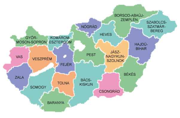
Map_of_counties_of_Hungary_2004.png (602 × 396 Pixel, Dateigress: 34 KB, MIME-Typ: image/png)

|
File:Map of counties of Hungary 2004.svg ist eine vektorisierte Version dieses Bildes. Diese sollte an Stelle des Rasterbildes verwendet werden, sofern sie nicht schlechter ist.
File:Map of counties of Hungary 2004.png → File:Map of counties of Hungary 2004.svg
Für weitere Informationen siehe Help:SVG. |
 |
Bschreiwung
Español: Provincias de Hungría
Counties of Hungary
Uploaded to hu: on August 26, 2004 by hu:User:Szajd and licensed under GFDL

|
Es ist erlaubt, die Datei unter den Bedingungen der GNU-Lizenz für freie Dokumentation, Version 1.2 oder einer späteren Version, veröffentlicht von der Free Software Foundation, zu kopieren, zu verbreiten und/oder zu modifizieren; es gibt keine unveränderlichen Abschnitte, keinen vorderen und keinen hinteren Umschlagtext.
Der vollständige Text der Lizenz ist im Kapitel GNU-Lizenz für freie Dokumentation verfügbar. |
| Diese Datei ist unter der Creative-Commons-Lizenz „Namensnennung – Weitergabe unter gleichen Bedingungen 3.0 nicht portiert“ lizenziert. | ||
| ||
| Diese Lizenzmarkierung wurde auf Grund der GFDL-Lizenzaktualisierung hinzugefügt. |
Dateiversiona
Wensd auf an Zeitpunkt klickst, nacha konst a friaane Version lodn.
| Version vom | Vorschaubuidl | Dimensióna | Nutzer | Kommentar | |
|---|---|---|---|---|---|
| aktuell | 12:36, 26. Nóv. 2016 | | 602 × 396 (34 KB) | Tacsipacsi | transparent background |
| 15:03, 2. Mer. 2007 |  | 602 × 396 (14 KB) | Tene~commonswiki | Optimised (0) | |
| 06:03, 6. Jun. 2005 |  | 602 × 396 (15 KB) | Thuresson | Counties of Hungary Uploaded to hu: on August 26, 2004 by hu:User:Szajd and licensed under GFDL {{GFDL}} Category:Maps of Hungary hu:Kép:Magyarorszag-megyek.png |
Dateivawendung
Seitn wo de Datei nutzn:
Globale Dateinutzung
D'noochéfóiganden åndern Wikis vawénden dé Datei:
- Vawendung af als.wikipedia.org
- Vawendung af be-tarask.wikipedia.org
- Vawendung af cs.wikipedia.org
- Vawendung af da.wikipedia.org
- Vawendung af de.wikipedia.org
- Vawendung af en.wikipedia.org
- Vawendung af eo.wikipedia.org
- Vawendung af fiu-vro.wikipedia.org
- Vawendung af frr.wikipedia.org
- Vawendung af fr.wikipedia.org
- Vawendung af gl.wikipedia.org
- Vawendung af hu.wikipedia.org
- Vawendung af is.wikipedia.org
- Vawendung af it.wikipedia.org
- Vawendung af nrm.wikipedia.org
- Vawendung af oc.wikipedia.org
- Vawendung af pl.wikipedia.org
- Vawendung af ro.wikipedia.org
- Vawendung af rue.wikipedia.org
- Vawendung af sh.wikipedia.org
- Vawendung af sk.wikipedia.org
- Vawendung af tr.wikipedia.org
- Vawendung af vi.wikipedia.org