Datei:NSW in Australia map.png
Es gibt koa hehare Aflesung.
NSW_in_Australia_map.png (200 × 186 Pixel, Dateigress: 11 KB, MIME-Typ: image/png)

|
File:New South Wales in Australia.svg ist eine vektorisierte Version dieses Bildes. Diese sollte an Stelle des Rasterbildes verwendet werden, sofern sie nicht schlechter ist.
File:NSW in Australia map.png → File:New South Wales in Australia.svg
Für weitere Informationen siehe Help:SVG. |
 |
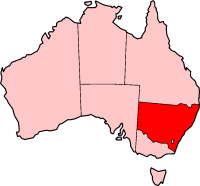
New South Wales location - (from en.wikipedia.org)

|
Es ist erlaubt, die Datei unter den Bedingungen der GNU-Lizenz für freie Dokumentation, Version 1.2 oder einer späteren Version, veröffentlicht von der Free Software Foundation, zu kopieren, zu verbreiten und/oder zu modifizieren; es gibt keine unveränderlichen Abschnitte, keinen vorderen und keinen hinteren Umschlagtext.
Der vollständige Text der Lizenz ist im Kapitel GNU-Lizenz für freie Dokumentation verfügbar. |
| Diese Datei ist unter der Creative-Commons-Lizenz „Namensnennung – Weitergabe unter gleichen Bedingungen 3.0 nicht portiert“ lizenziert. | ||
| ||
| Diese Lizenzmarkierung wurde auf Grund der GFDL-Lizenzaktualisierung hinzugefügt. |
Dateiversiona
Wensd auf an Zeitpunkt klickst, nacha konst a friaane Version lodn.
| Version vom | Vorschaubuidl | Dimensióna | Nutzer | Kommentar | |
|---|---|---|---|---|---|
| aktuell | 05:24, 27. Nóv. 2004 | | 200 × 186 (11 KB) | Jeroen | New South Wales location - (from en.wikipedia.org) |
Dateivawendung
Seitn wo de Datei nutzn:
Globale Dateinutzung
D'noochéfóiganden åndern Wikis vawénden dé Datei:
- Vawendung af de.wikipedia.org
- Vawendung af en.wikipedia.org
- Ghin-Doo-Ee National Park
- Goulburn River National Park
- Mount Royal National Park
- Towarri National Park
- Wallingat National Park
- Watagans National Park
- See Change Festival
- Swansea, New South Wales
- Australian south-east coast drainage division
- Come By Chance, New South Wales
- Lake Burrendong
- Highways in New South Wales
- Bonshaw, New South Wales
- Shellharbour, New South Wales
- Goolmangar, New South Wales
- Pilliga, New South Wales
- Tooraweenah
- Woodenbong
- Exeter, New South Wales
- Western Division (New South Wales)
- Tarana, New South Wales
- City of Queanbeyan
- Medlow Bath, New South Wales
- Lake Victoria (New South Wales)
- Wilsons Peak
- Belford, New South Wales
- Mount Hutton, New South Wales
- Clunes, New South Wales
- Goonellabah, New South Wales
- Muster (census)
- Southern Tablelands
- Mount Pleasant, New South Wales
- Narrabri Stellar Intensity Interferometer
- Valla, New South Wales
- Terry Hie Hie, New South Wales
- Milson Island
- Tallimba
- Perrys Lookdown
- Evans Lookout
- Nepean Gorge
- Shark Island (Cronulla Beach)
- Linden, New South Wales
- Capital Country
- Mororo, New South Wales
- Wonboyn Lake
- Horsley, New South Wales
- Cullen Bullen, New South Wales
- Pigeon House Mountain
- Lemon Tree Passage, New South Wales
Weitere globale Verwendungen dieser Datei anschauen.