Datei:Shetland UK location map.svg

Größe der PNG-Vorschau dieser SVG-Datei: 315 × 599 Pixel. Weitere Auflésungan: 126 × 240 Pixel | 252 × 480 Pixel | 404 × 768 Pixel | 538 × 1.024 Pixel | 1.077 × 2.048 Pixel | 832 × 1.582 Pixel.
Version in hechara Auflesung (SVG-Datei, Basisgress: 832 × 1.582 Pixl, Dateigress: 1,63 MB)
| Bschreiwung |
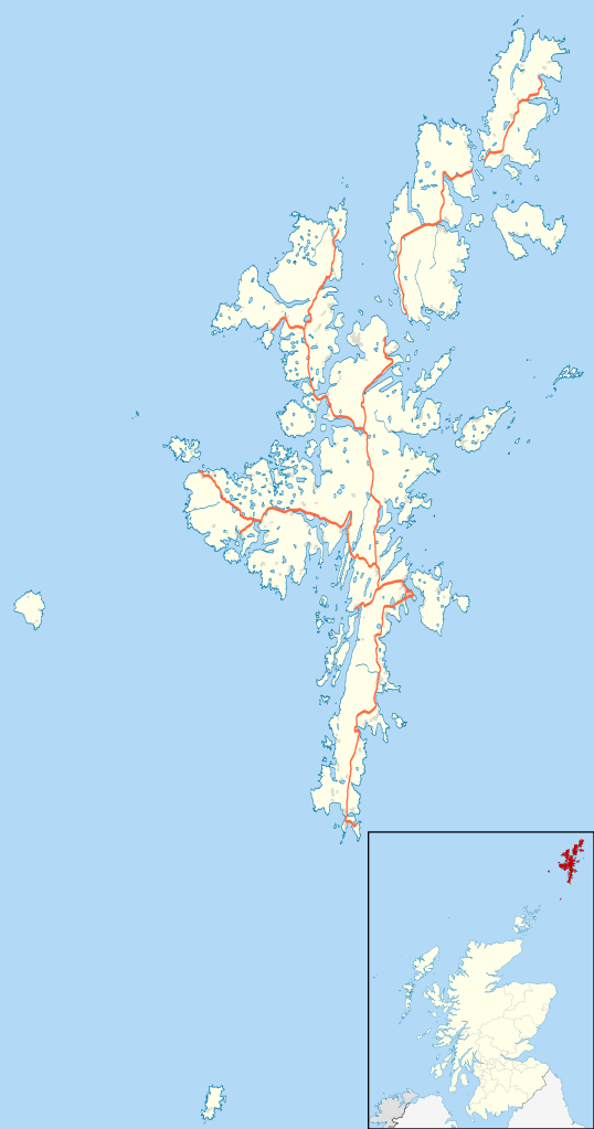
Blank map of the Shetland Islands, UK with the following information shown:
Equirectangular map projection on WGS 84 datum, with N/S stretched 200% Geographic limits:
|
| Daatum | |
| Quejn |
|
| Urhéwer | Nilfanion, created using Ordnance Survey data |
| Gnémigung (Weidernutzung voh derer Daatei) |
Diese Datei ist unter der Creative-Commons-Lizenz „Namensnennung – Weitergabe unter gleichen Bedingungen 3.0 nicht portiert“ lizenziert. Namensnennung: Contains Ordnance Survey data © Crown copyright and database right
|
| Aundre Versióner | File:Shetland UK blank map.svg - Blank map |
Dateiversiona
Wensd auf an Zeitpunkt klickst, nacha konst a friaane Version lodn.
| Version vom | Vorschaubuidl | Dimensióna | Nutzer | Kommentar | |
|---|---|---|---|---|---|
| aktuell | 22:25, 26. Sep. 2010 | | 832 × 1.582 (1,63 MB) | Nilfanion | {{Information |Description=Blank map of the Shetland Islands, UK with the following information shown: *Administrative borders *Coastline, lakes and rivers *Roads and railways *Urban areas Equirectangular map projection on WGS 84 d |
Dateivawendung
Seitn wo de Datei nutzn:
Globale Dateinutzung
D'noochéfóiganden åndern Wikis vawénden dé Datei:
- Vawendung af ar.wikipedia.org
- Vawendung af be-tarask.wikipedia.org
- Vawendung af bg.wikipedia.org
- Vawendung af ceb.wikipedia.org
- Vawendung af de.wikipedia.org
- Vawendung af en.wikipedia.org
- Shetland
- Lerwick
- Jarlshof
- RAF Saxa Vord
- Broch of Mousa
- Broch of Clickimin
- Sumburgh Airport
- Skaw, Unst
- Grutness
- Twatt, Shetland
- Neap
- Brae
- Haroldswick
- Aith
- Scalloway
- Old Scatness
- Mail, Shetland
- Tingwall Airport
- Fair Isle Airport
- Bigton
- Cutts, Shetland
- Broch of Culswick
- Vidlin
- Mossbank, Shetland
- Scatsta Airport
- Aywick
- Westerfield, Shetland
- Clivocast
- RAF Sumburgh
- Walls, Shetland
- North Roe
Weitere globale Verwendungen dieser Datei anschauen.